The Blue Ridge
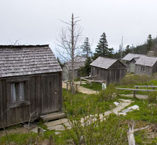
Monday, May 23, 2005: There's nothing quite like sleeping in comfort to restore you. My knee felt fine this morning. I walked about 1.5 miles of the trails at the Chalet Inn (then have 22 acres, mostly wooded) and it still felt fine. The trails are well-maintained, with some nice switchbacks. They also have several side-trails that lead to hammocks for those who want to relax. I had breakfast following my walk.
I stopped briefly at the park's visitor center, then backtracked to the south end of the Blue Ridge Parkway. I stayed on the parkway until about 3pm, making surprisingly little progress. The slow progress was not due to heavy traffic (traffic was quite light) or construction, but rather because I stopped at many of the turnouts and either birded or walked.
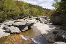
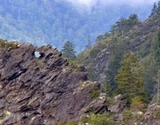
The two main trails I walked were the Waterrock Knob Trail (mile 451.2, 1.2 miles roundtrip, 574'), and the Richard Balsam Trail (mile 432.0, 1.4 miles, 390'). Chestnut-sided Warblers were all over the place, ravens could be heard hidden behind ridges and sometimes overhead. Quite a few Black-throated Green and Blue Warblers were present. The Richard Balsam Trail had Black-capped Chickadees, Juncos, and lots of Golden-crowned Kinglets. Winter Wrens were heard, but not seen. A Veery was singing near one of the overlooks. A Blue-headed Vireo near the octagonal platform at the Roy Taylor Forest Overlook (mile 433.3) did a good imitation of a Chat! Some Canada Warblers were near the highest point of the parkway (near Richard Balsam). No wonder I didn't get very far!
|
|
|
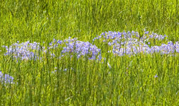
| Blue-eyed Grass | Waterrock Knob | |
|---|---|---|
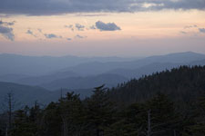
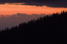
After a rest, and dinner, I headed up Clingman's Dome for sunset. It was cold and windy up there! I passed several people on the short trail up from the parking lot. I took lots of sunset pictures. I had hoped to hear some owls on the way back, but did not. Given the wind, this wasn't surprising.
| Clingman's Dome Sunset | ||
|---|---|---|
|
|
|
It was a good, relaxing day. Even so, I walked over 5 miles and gained around 1500 feet! Things are looking good for a hike up Mt. Le Conte on Wednesday. My trip bird total is now 84 species.
Whittier NC
Mt. Pisgah Area
Tuesday, May 24, 2005: After being out late, I slept late today, having breakfast at 8. I enjoyed the Blue Ridge yesterday and decided to repeat it today! I started a bit south of where I left off. I again saw the Blue-headed Vireo with the chat-like song and was very pleased to find a Blackburnian Warbler there also.
|
|
|
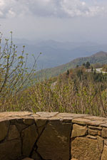
| Devil's Courthouse | Yellowstone Prong | |
|---|---|---|
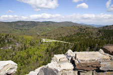
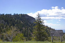
I did the trail at Devil's Courthouse (mile 422.4, 1.0 miles, 258') and wandered about in Graveyard Fields (roughly 1.3 miles). At the latter, I found more Canada Warblers and a pair of Kentucky Warblers. I had a late lunch at the Mt. Pisgah Inn. I was planning to hike up the Pisgah Trail, to the top of Mt. Pisgah. After lunch, I noticed some dark clouds overhead when I stepped outside. By the time I was in my car, it was raining, so I skipped the trail.
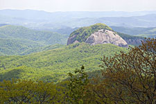
|
|
| Looking Glass Rock | Blue Ridge View |
|---|
I continued up the Blue Ridge to near Asheville. I briefly visited the French Broad River where Chimney Swifts were flying low over the water, then returned to the Chalet Inn via the main highway.
I ate at Lulu's in Sylva and got to bed early. Tomorrow is Mt. Le Conte. Breakfast at the Chalet Inn is normally from 8-9, but Hanneke is leaving me a breakfast-to-go in the refrigerator so I can get a early start tomorrow. My trip bird total is up to 91 species.
Whittier NC
Mt. Le Conte!
Wednesday, May 25, 2005: I left the Chalet Inn before 7 and arrived at the Alum Cave Bluffs trailhead by 8. This was plenty early to get me a prime parking spot. It was cloudy and cold (40 degrees), so I started out wearing a jacket. Given the length of the hike, I decided to use trekking poles.
I headed up the trail, birding on the way. A Magnolia Warbler was an addition to my triplist. The trail is fairly easy at the start, as it follows alongside a stream (and a tributary) for over a mile. It crosses the stream several times, often on improved logs (with the top flattened and a railing added).
After it leaves the stream, the trail starts to climb more seriously. At about 2 miles, the trail goes through Arch Rock. There are steps leading up through the arch. Further up the trail you can view the "Eye of the Needle" (an opening in the rock atop a ridge). Even though it is still cold, I took off both the jacket and hat. Going uphill is hot work! I had planned to take more photos, but have realized I forgot to recharge the camera battery. It indicates a low battery, so I'll wait until I get to the top to take pictures, then take what battery and energy permit on the way down.
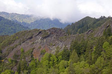
|
|
|
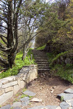
| Duck Hawk Ridges | Eye of the Needle | Alum Cave Bluff |
|---|
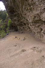
The next landmark is Alum Cave Bluffs, 2.3 miles from the trailhead. Although someone else saw a Peregrine here today, I was not so fortunate. The trail then descends a bit as it crosses a saddle before resuming it's upward climb. There are steps at a couple of points, including some interesting steps carved out of a single log that you walk lengthwise uphill. The drop offs are quite steep at some points. The vegetation disguises exactly how much exposure there is on the upper part of this trail. At about 12:15, I reached the lodge at the top. A few minutes later I was at High Top, the highest point on the summit (6593 feet).
|
|
|
| High Top | Myrtle Point | Le Conte Lodge |
|---|
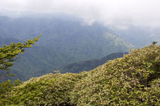
I walked out toward Myrtle Point (.7 from the lodge). I saw some deer on the way (up on the summit!). At Myrtle Point I sat down for a rest, to eat, and to hope the clouds shrouding some of the nearby summits would clear for a good view. They didn't. A couple of Carolina Juncos were foraging there, sometimes coming quite close. After a rest, I headed over to Cliff Tops to check out the view there. It was also cloud-shrouded. Sometime after 1:30 I started back down and almost 4pm when I reached the car.
After 11 3/4 miles of hiking (gaining and then losing 2800 feet), I took it easy the rest of the day. Dinner was at Karen's in Sylva. My trip bird total is 92 species.
Whittier NC
Gorge and Mountain
Thursday, May 26, 2005:
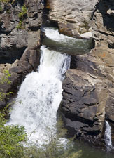
|
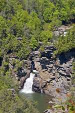
|
| Linville Falls | |
|---|---|
Since I've been on the parkway up to Asheville, I skipped that part this time. There's still a section south of Linville Falls that is closed due to last year's Hurricane Frances, so I rejoined the parkway at mile 316, just north of the closure. Almost immediately, I turned into Linville Falls. The visitor's center was still being repaired, but the trails and overlooks were mostly open (one overlook was closed) and I viewed the falls from several vantage points.
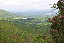
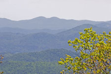
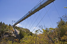
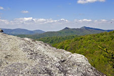
I headed up the parkway, stopping at various overlooks, until I got to the Grandfather Mountain exit. Grandfather Mountain is a private nature preserve with a $14 entrance fee. I ate lunch there, and checked out the "mile-high swinging bridge" at the top. It was quite windy up there. When I walked below the bridge, I could hear the cables humming in the wind, an eerie "bridge symphony".
|
|
|
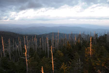
| Parkway View | Singing Bridge | View from Grandfather Mtn. |
|---|
After leaving Grandfather Mountain, I went a bit further up the parkway, then headed east. I stopped for the night at Rocky Mount, only a couple of hours from the coast. My trip bird total is 94 species.
Rocky Mount NC